- Член од
- 3 септември 2010
- Мислења
- 6.789
- Поени од реакции
- 9.392
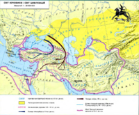
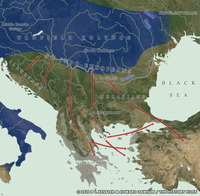
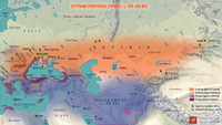
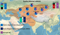
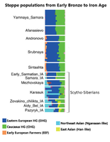
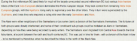
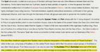
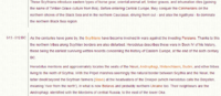
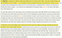
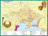
What's in a Name - Sakas & Scythians
A name breakdown for the Saka and Scythians (essentially the same name in different forms) is an interesting one to explore.


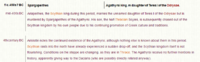
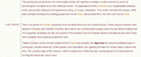
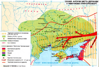
Kingdoms of Europe - Scythians (Indo-Iranians)
Coverage of the various historical cultures, rulers, and states of Europe

Последно уредено: